Category:1890s maps of California
States of the United States: Alabama · Alaska · Arizona · Arkansas · California · Colorado · Connecticut · Delaware · Florida · Georgia · Hawaii · Idaho · Illinois · Indiana · Iowa · Kansas · Kentucky · Louisiana · Maine · Maryland · Massachusetts · Michigan · Minnesota · Mississippi · Missouri · Montana · Nebraska · Nevada · New Hampshire · New Jersey · New Mexico · New York · North Carolina · North Dakota · Ohio · Oklahoma · Oregon · Pennsylvania · Rhode Island · South Carolina · South Dakota · Tennessee · Texas · Utah · Vermont · Virginia · Washington · West Virginia · Wisconsin · Wyoming – Washington, D.C.
Puerto Rico
Puerto Rico
Subcategories
This category has the following 47 subcategories, out of 47 total.
A
B
C
E
F
G
L
M
R
S
T
Media in category "1890s maps of California"
The following 24 files are in this category, out of 24 total.
-
 1890 Redondo Quadrangle.jpg 2,936 × 3,596; 2.51 MB
-

-
 US-MAPS(1891) p466 - MAP OF CALIFORNIA, NEVADA AND ALASKA (l).jpg 2,160 × 1,504; 1.07 MB
-
 US-MAPS(1891) p467 - MAP OF CALIFORNIA, NEVADA AND ALASKA (r).jpg 2,160 × 1,504; 979 KB
-

-
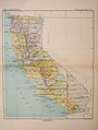
 Map of California and Nevada.jpg 2,934 × 3,515; 2.45 MB
-

-
 194 of 'United States Pictures. Drawn with pen and pencil, etc' (11210503504).jpg 2,896 × 1,937; 1.33 MB
-
-
 Brewer Island, USGS, 1899.png 1,500 × 1,500; 3.9 MB
-
 CA Goodyear Bahai 1896 62500.jpg 432 × 332; 78 KB
-
 GrassValley 1895.jpg 524 × 636; 189 KB
-
 Hooks Island, California, USGS survey map 1899 (1899 edition).png 700 × 700; 645 KB
-
 Karquines 1898.jpg 1,134 × 660; 485 KB
-
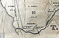
 Lake Valley RR 1893.jpg 512 × 1,040; 256 KB
-
 Los Angeles and Independence Railroad.jpg 1,091 × 273; 222 KB
-
 Purisima 1894.jpg 1,960 × 1,270; 667 KB
-
 Sacramento. LOC 75693099.tif 11,264 × 7,072; 227.91 MB
-
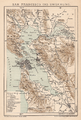 SAN FRANCISCO UND UMGEBUNG.png 2,000 × 2,961; 12.32 MB
-
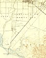
 San Joaquin and Sierra Nevada Railroad through Lodi.jpg 2,058 × 726; 385 KB
-
 San pedro East and West jetties in 1870 and 1890.png 869 × 510; 273 KB
-
 Santa Ana and Newport Railway.jpg 1,277 × 1,622; 606 KB
-
 Silva Island, USGS, 1897.png 400 × 400; 319 KB
-
 Simms Island, USGS, 1897.png 300 × 300; 184 KB

.jpg)
_p466_-_MAP_OF_CALIFORNIA,_NEVADA_AND_ALASKA_(l).jpg)
_p467_-_MAP_OF_CALIFORNIA,_NEVADA_AND_ALASKA_(r).jpg)
.jpg)

_(14776238882).jpg)
.jpg)
_(18741225423).jpg)


.png)


