Category:1895 maps of California
States of the United States: California · Connecticut · Florida · Georgia · Illinois · Indiana · Iowa · Kentucky · Louisiana · Maine · Maryland · Massachusetts · Michigan · Minnesota · Mississippi · Missouri · Nevada · New Jersey · New York · Ohio · Oklahoma · Oregon · Pennsylvania · Rhode Island · South Carolina · Tennessee · Texas · Utah · Vermont · Virginia · Washington · West Virginia · Wisconsin · Wyoming – Washington, D.C.
| ← 1890 1891 1892 1893 1894 1895 1896 1897 1898 1899 → |
Subcategories
This category has the following 17 subcategories, out of 17 total.
S
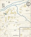
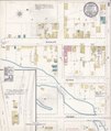
Media in category "1895 maps of California"
The following 139 files are in this category, out of 139 total.
-
 1895 topo showing the Berkeley Branch Railroad.jpg 410 × 633; 196 KB
-

-
 Sanborn Fire Insurance Map from Altaville, Calaveras County, California. LOC sanborn00379 002.tif 6,450 × 7,650; 141.17 MB
-

-
 Sanborn Fire Insurance Map from Amador, Amador County, California. LOC sanborn00383 002-1.tif 6,450 × 7,650; 141.17 MB
-

-
 Sanborn Fire Insurance Map from Amador, Amador County, California. LOC sanborn00383 002-2.tif 6,450 × 7,650; 141.17 MB
-

-
 Sanborn Fire Insurance Map from Angels Camp, Calaveras County, California. LOC sanborn00386 002.tif 6,450 × 7,650; 141.17 MB
-

-

-

-

-

-

-

-

-
 Sanborn Fire Insurance Map from Chino, San Bernardino County, California. LOC sanborn00460 001-1.tif 6,450 × 7,650; 141.17 MB
-

-
 Sanborn Fire Insurance Map from Chino, San Bernardino County, California. LOC sanborn00460 001-2.tif 6,450 × 7,650; 141.17 MB
-

-
 Sanborn Fire Insurance Map from Chino, San Bernardino County, California. LOC sanborn00460 001-3.tif 6,450 × 7,650; 141.17 MB
-

-
 Sanborn Fire Insurance Map from Chino, San Bernardino County, California. LOC sanborn00460 001-4.tif 6,450 × 7,650; 141.17 MB
-

-

-

-

-

-
 Sanborn Fire Insurance Map from Elk Grove, Sacramento County, California. LOC sanborn00524 003-1.tif 6,450 × 7,650; 141.17 MB
-

-
 Sanborn Fire Insurance Map from Elk Grove, Sacramento County, California. LOC sanborn00524 003-2.tif 6,450 × 7,650; 141.17 MB
-

-

-

-

-

-
 Sanborn Fire Insurance Map from Lodi, San Joaquin County, California. LOC sanborn00644 003-1.tif 6,450 × 7,650; 141.17 MB
-

-
 Sanborn Fire Insurance Map from Lodi, San Joaquin County, California. LOC sanborn00644 003-2.tif 6,450 × 7,650; 141.17 MB
-

-
 Sanborn Fire Insurance Map from Lodi, San Joaquin County, California. LOC sanborn00644 003-3.tif 6,450 × 7,650; 141.17 MB
-

-
 Sanborn Fire Insurance Map from Lodi, San Joaquin County, California. LOC sanborn00644 003-4.tif 6,450 × 7,650; 141.17 MB
-

-
 Sanborn Fire Insurance Map from Lodi, San Joaquin County, California. LOC sanborn00644 003-5.tif 6,450 × 7,650; 141.17 MB
-

-
 Sanborn Fire Insurance Map from Lodi, San Joaquin County, California. LOC sanborn00644 003-6.tif 6,450 × 7,650; 141.17 MB
-

-
 Sanborn Fire Insurance Map from Lodi, San Joaquin County, California. LOC sanborn00644 003-7.tif 6,450 × 7,650; 141.17 MB
-

-

-

-

-

-

-

-

-

-

-

-
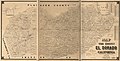
 Map of California roads for cyclers. LOC 97683587.jpg 6,576 × 8,240; 10.73 MB
-
 Map of California roads for cyclers. LOC 97683587.tif 6,576 × 8,240; 155.03 MB
-
-

-

-
 Sanborn Fire Insurance Map from Acampo, San Joaquin County, California. LOC sanborn00372 001.tif 6,450 × 7,650; 141.17 MB
-

-
 Sanborn Fire Insurance Map from Banning, Riverside County, California. LOC sanborn00406 001.tif 6,450 × 7,650; 141.17 MB
-

-
 Sanborn Fire Insurance Map from Beaumont, Riverside County, California. LOC sanborn00411 001.tif 6,450 × 7,650; 141.17 MB
-

-
 Sanborn Fire Insurance Map from Brentwood, Contra Costa County, California. LOC sanborn00434 001.tif 6,450 × 7,650; 141.17 MB
-

-

-

-
 Sanborn Fire Insurance Map from Downey, Los Angeles County, California. LOC sanborn00507 003.jpg 8,621 × 10,094; 5.97 MB
-
 Sanborn Fire Insurance Map from Downey, Los Angeles County, California. LOC sanborn00507 003.tif 8,621 × 10,094; 248.97 MB
-
-
 Sanborn Fire Insurance Map from Felton, Santa Cruz County, California. LOC sanborn00539 001.tif 6,450 × 7,650; 141.17 MB
-

-
 Sanborn Fire Insurance Map from Fillmore, Ventura County, California. LOC sanborn00542 001.tif 6,450 × 7,650; 141.17 MB
-

-
-

-

-

-
 Sanborn Fire Insurance Map from Milton, Calaveras County, California. LOC sanborn00688 002.tif 6,450 × 7,650; 141.17 MB
-

-

-

-
 Sanborn Fire Insurance Map from San Andreas, Calaveras County, California. LOC sanborn00803 002.tif 6,450 × 7,650; 141.17 MB
-

-

-

-
 Sanborn Fire Insurance Map from Tres Pinos, San Benito County, California. LOC sanborn00893 003.tif 6,450 × 7,650; 141.17 MB
-
 Sanborn Fire Insurance Map from Tustin, Orange County, California. LOC sanborn00900 001.jpg 6,450 × 7,650; 3.45 MB
-
 Sanborn Fire Insurance Map from Tustin, Orange County, California. LOC sanborn00900 001.tif 6,450 × 7,650; 141.17 MB
-

-

-

-

-

-

-

-

-

-

-

-

-

-

-

-

-

-

-

-

-

-

-
 Sanborn Fire Insurance Map from Sonora, Tuolumne County, California. LOC sanborn00859 002-1.jpg 8,828 × 10,481; 7.63 MB
-
 Sanborn Fire Insurance Map from Sonora, Tuolumne County, California. LOC sanborn00859 002-1.tif 8,828 × 10,481; 264.72 MB
-
 Sanborn Fire Insurance Map from Sonora, Tuolumne County, California. LOC sanborn00859 002-2.jpg 8,850 × 10,455; 7.82 MB
-
 Sanborn Fire Insurance Map from Sonora, Tuolumne County, California. LOC sanborn00859 002-2.tif 8,850 × 10,455; 264.72 MB
-
 Sanborn Fire Insurance Map from Sonora, Tuolumne County, California. LOC sanborn00859 002-3.jpg 8,815 × 10,422; 8.22 MB
-
 Sanborn Fire Insurance Map from Sonora, Tuolumne County, California. LOC sanborn00859 002-3.tif 8,815 × 10,422; 262.84 MB
-
 StocktonCalifornia1895aerialview.jpg 1,538 × 1,050; 522 KB
-
 The city of Stockton, San Joaquin County, Cal. 1895. LOC 75693116.jpg 12,304 × 8,400; 25.38 MB
-
 The city of Stockton, San Joaquin County, Cal. 1895. LOC 75693116.tif 12,304 × 8,400; 295.7 MB
-
 View of city of Stockton, the Manufacturing City of California. LOC 75693117.jpg 12,432 × 8,400; 25.28 MB
-
 View of city of Stockton, the Manufacturing City of California. LOC 75693117.tif 12,432 × 8,400; 298.77 MB
-
-

-

-

-

-

-

-


_(14758341436).jpg)


