Category:1895 maps of Washington (state)
States of the United States: California · Connecticut · Florida · Georgia · Illinois · Iowa · Kentucky · Louisiana · Maine · Maryland · Massachusetts · Michigan · Minnesota · Mississippi · Missouri · Nevada · New Jersey · New York · Ohio · Oklahoma · Oregon · Pennsylvania · Rhode Island · South Carolina · Tennessee · Texas · Utah · Vermont · Virginia · Washington · West Virginia · Wisconsin · Wyoming – Washington, D.C.
| ← 1890 1891 1892 1893 1894 1895 1896 1897 1898 1899 → |
Media in category "1895 maps of Washington (state)"
The following 5 files are in this category, out of 5 total.
-
 1895 Mount Rainier map Henry Mason Sarvant.png 771 × 800; 1.39 MB
-
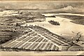 Bird's eye view of Rainier Beach, 1895.jpg 3,387 × 2,271; 1.77 MB
-
 Map of Cowlitz County, Washington LOC 2012593136.jpg 12,065 × 9,695; 14.89 MB
-
 Map of Cowlitz County, Washington LOC 2012593136.tif 12,065 × 9,695; 334.65 MB
-
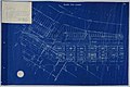 Seattle Tide Lands, Volume Two, page 28, March 15, 1895 (MOHAI 13415).jpg 1,200 × 802; 150 KB


.jpg)