Category:1890s maps of Massachusetts
States of the United States: Alabama · Alaska · Arizona · Arkansas · California · Colorado · Connecticut · Delaware · Florida · Georgia · Hawaii · Idaho · Illinois · Indiana · Iowa · Kansas · Kentucky · Louisiana · Maine · Maryland · Massachusetts · Michigan · Minnesota · Mississippi · Missouri · Montana · Nebraska · Nevada · New Hampshire · New Jersey · New Mexico · New York · North Carolina · North Dakota · Ohio · Oklahoma · Oregon · Pennsylvania · Rhode Island · South Carolina · South Dakota · Tennessee · Texas · Utah · Vermont · Virginia · Washington · West Virginia · Wisconsin · Wyoming – Washington, D.C.
Puerto Rico
Puerto Rico
Subcategories
This category has the following 12 subcategories, out of 12 total.
B
S
Media in category "1890s maps of Massachusetts"
The following 6 files are in this category, out of 6 total.
-
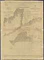 From Muskeget Channel to Buzzards Bay and entrance to Vineyard Sound, Mass. (3120016189).jpg 1,465 × 2,000; 2.65 MB
-
 US-MAPS(1891) p482 - MAP OF MASSACHUSETTS.jpg 2,160 × 1,504; 1.06 MB
-

-
 Lowell Lawrence and Haverhill Street Railway Company c 1894.png 1,762 × 1,216; 1.2 MB
-
 Map of Boston (2674802865).jpg 2,000 × 1,545; 3.09 MB
-
 Proposed development of Fairbanks Park, Dedham, Mass. (2673673887).jpg 2,000 × 1,544; 2.76 MB
.jpg)
_p482_-_MAP_OF_MASSACHUSETTS.jpg)
.jpg)

.jpg)
.jpg)