Category:1897 maps of Massachusetts
States of the United States: Alaska · California · Connecticut · Delaware · Florida · Georgia · Idaho · Illinois · Iowa · Kansas · Kentucky · Maine · Maryland · Massachusetts · Michigan · Minnesota · Mississippi · Missouri · Montana · Nevada · New Jersey · New York · North Carolina · North Dakota · Ohio · Oregon · Pennsylvania · South Carolina · South Dakota · Tennessee · Texas · Virginia · Washington · West Virginia · Wisconsin – Washington, D.C.
| ← 1890 1891 1892 1893 1894 1895 1896 1897 1898 1899 → |
Subcategories
This category has the following 2 subcategories, out of 2 total.
Media in category "1897 maps of Massachusetts"
The following 9 files are in this category, out of 9 total.
-

-
 1897 Newton Centre, Massachusetts bird's eye view.jpg 8,592 × 6,704; 14.14 MB
-
 Annual report of the Massachusetts Highway Commission (1897) (14776483633).jpg 3,122 × 2,018; 1.21 MB
-
 Map of Quincy (9137936066).jpg 800 × 568; 119 KB
-
 Maplewood and Linden, Massachusetts, 1897 (2674536800).jpg 2,000 × 1,439; 2.2 MB
-
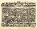
 Massachusetts map by The Century Co., 1897.jpg 9,687 × 7,002; 33.19 MB
-
 Newton Centre, Massachusetts 1897. LOC 74693148.jpg 8,592 × 6,704; 12.6 MB
-
 Wards 1 and 7, Newton, Massachusetts 1897. LOC 74693149.jpg 8,032 × 5,440; 9.76 MB
-
 West Medford, Massachusetts (2674495554).jpg 2,000 × 1,426; 2.16 MB
_Map_of_Boston_and_metropolitan_district_by_Geo._H._Walker_%26_Co,_from_the_Digital_Commonwealth_-_commonwealth_wd3767242.jpg)

_(14776483633).jpg)
.jpg)
.jpg)


.jpg)