Category:1894 maps of Massachusetts
States of the United States: California · Connecticut · Illinois · Iowa · Kansas · Kentucky · Louisiana · Maine · Maryland · Massachusetts · Michigan · Minnesota · Mississippi · Missouri · Montana · New Hampshire · New York · North Carolina · Ohio · Oklahoma · Oregon · Pennsylvania · Rhode Island · South Carolina · South Dakota · Tennessee · Texas · Utah · Vermont · Virginia · Washington · West Virginia · Wisconsin · Wyoming – Washington, D.C.
| ← 1890 1891 1892 1893 1894 1895 1896 1897 1898 1899 → |
Subcategories
This category has the following 3 subcategories, out of 3 total.
Media in category "1894 maps of Massachusetts"
The following 19 files are in this category, out of 19 total.
-
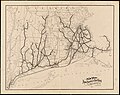 1894 New York, New Haven and Hartford Railroad map.jpg 5,761 × 4,560; 3.01 MB
-

-
 Atlas-Mass-Hampden-Co 1894 006.jpg 9,848 × 5,370; 15.01 MB
-
 Atlas-Mass-Hampden-Co 1894 018.jpg 7,831 × 5,507; 10.9 MB
-
 Atlas-Mass-Hampden-Co 1894 020.jpg 7,831 × 5,507; 11.08 MB
-
 Atlas-Mass-Hampden-Co 1894 022.jpg 7,817 × 5,507; 11.79 MB
-
 Chatham, Massachusetts 1894 (14961816432).jpg 2,000 × 1,360; 2.47 MB
-

-

-
 Hyannis Harbor, Massachusetts (3120842544).jpg 2,000 × 1,926; 3.32 MB
-
 Map of Massachusetts.jpg 3,561 × 2,942; 3.52 MB
-
 Map of the city of Cambridge LOC 86697335.tif 9,875 × 5,201; 146.94 MB
-
 Map of the city of Newton, and surroundings, Mass. (5121139420).jpg 2,000 × 1,538; 3.04 MB
-

-
 Naval Hospital grounds, Chelsea, Mass. LOC 2010589269.jpg 11,484 × 5,868; 4.12 MB
-
 Naval Hospital grounds, Chelsea, Mass. LOC 2010589269.tif 11,484 × 5,868; 192.8 MB
-
 The city of Newburyport, Massachusetts (2675439266).jpg 2,000 × 1,372; 2.83 MB
-
 Winthrop, Mass. LOC 75694611.jpg 7,808 × 5,376; 4.84 MB
-
 Winthrop, Mass. LOC 75694611.tif 7,808 × 5,376; 120.09 MB

_(page_11_crop).jpg)


.jpg)
.jpg)
_..._(7557366372).jpg)
.jpg)

.jpg)
.jpg)

.jpg)
