Category:1894 maps of Texas
States of the United States: California · Connecticut · Illinois · Iowa · Kansas · Kentucky · Louisiana · Maine · Maryland · Massachusetts · Michigan · Minnesota · Mississippi · Missouri · Montana · New Hampshire · New York · North Carolina · Ohio · Oklahoma · Oregon · Pennsylvania · Rhode Island · South Carolina · South Dakota · Tennessee · Texas · Utah · Vermont · Virginia · Washington · West Virginia · Wisconsin · Wyoming – Washington, D.C.
| ← 1890 1891 1892 1893 1894 1895 1896 1897 1898 1899 → |
Subcategories
This category has the following 14 subcategories, out of 14 total.
S
Media in category "1894 maps of Texas"
The following 28 files are in this category, out of 28 total.
-
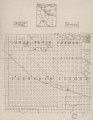
 (Map of portions of Jeff Davis County and Presidio County, Texas). LOC 2010587197.jpg 6,742 × 8,664; 6.53 MB
-
 (Map of portions of Jeff Davis County and Presidio County, Texas). LOC 2010587197.tif 6,742 × 8,664; 167.12 MB
-
 Bowie County, Texas LOC 2008628274.jpg 8,760 × 6,760; 6.46 MB
-
 Bowie County, Texas LOC 2008628274.tif 8,760 × 6,760; 169.42 MB
-
 Map of Martin County, Texas. LOC 2008621659.jpg 6,683 × 8,700; 6.9 MB
-
 Map of Martin County, Texas. LOC 2008621659.tif 6,683 × 8,700; 166.35 MB
-
 Map of Menard County, Texas LOC 2012590043.jpg 12,546 × 9,605; 17.64 MB
-
 Map of Menard County, Texas LOC 2012590043.tif 12,546 × 9,605; 344.77 MB
-
 Map of Texas.jpg 3,461 × 2,916; 3.38 MB
-
 Map of the west part of Tom Green County. LOC 2012592090.jpg 4,907 × 6,570; 4.47 MB
-
 Map of the west part of Tom Green County. LOC 2012592090.tif 4,907 × 6,570; 92.24 MB
-

-
 Sanborn Fire Insurance Map from Brackettville, Kinney County, Texas. LOC sanborn08438 001.tif 6,450 × 7,650; 141.17 MB
-
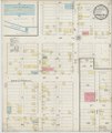
 Sanborn Fire Insurance Map from Goldthwaite, Mills County, Texas. LOC sanborn08546 001.jpg 6,450 × 7,650; 3.48 MB
-
 Sanborn Fire Insurance Map from Goldthwaite, Mills County, Texas. LOC sanborn08546 001.tif 6,450 × 7,650; 141.17 MB
-
 Sanborn Fire Insurance Map from Goliad, Goliad County, Texas. LOC sanborn08547 001.jpg 6,450 × 7,650; 3.3 MB
-
 Sanborn Fire Insurance Map from Marble Falls, Burnet County, Texas. LOC sanborn08640 001.jpg 6,450 × 7,650; 3.78 MB
-
 Sanborn Fire Insurance Map from Marble Falls, Burnet County, Texas. LOC sanborn08640 001.tif 6,450 × 7,650; 141.17 MB
-
 Sanborn Fire Insurance Map from Milford, Ellis County, Texas. LOC sanborn08659 001.jpg 6,450 × 7,650; 3.28 MB
-
 Sanborn Fire Insurance Map from Milford, Ellis County, Texas. LOC sanborn08659 001.tif 6,450 × 7,650; 141.17 MB
-
 Sanborn Fire Insurance Map from Rockport, Aransas County, Texas. LOC sanborn08722 001.jpg 6,450 × 7,650; 3.82 MB
-
 Sanborn Fire Insurance Map from Rockport, Aransas County, Texas. LOC sanborn08722 001.tif 6,450 × 7,650; 141.17 MB
-
 Sanborn Fire Insurance Map from Roma, Starr County, Texas. LOC sanborn08726 001.jpg 6,450 × 7,650; 3.57 MB
-
 Sanborn Fire Insurance Map from Roma, Starr County, Texas. LOC sanborn08726 001.tif 6,450 × 7,650; 141.17 MB
-
 Sanborn Fire Insurance Map from San Saba, San Saba County, Texas. LOC sanborn08746 003.jpg 6,450 × 7,650; 3.89 MB
-
 Sanborn Fire Insurance Map from San Saba, San Saba County, Texas. LOC sanborn08746 003.tif 6,450 × 7,650; 141.17 MB
-
 Sanborn Fire Insurance Map from Wharton, Wharton County, Texas. LOC sanborn08813 001.jpg 6,450 × 7,650; 3.52 MB
-
 USGS Reconnaissance Map of Tarrant County, Texas 1918 (1894 edition) UTA.jpg 4,004 × 5,040; 7.72 MB
._LOC_2010587197.jpg)


_UTA.jpg)