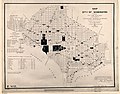
Category:1894 maps of Washington, D.C.
States of the United States: California · Connecticut · Illinois · Iowa · Kansas · Kentucky · Louisiana · Maine · Maryland · Massachusetts · Michigan · Minnesota · Mississippi · Missouri · Montana · New Hampshire · New York · North Carolina · Ohio · Oklahoma · Oregon · Pennsylvania · Rhode Island · South Carolina · South Dakota · Tennessee · Texas · Utah · Vermont · Virginia · Washington · West Virginia · Wisconsin · Wyoming – Washington, D.C.
| 1890 1891 1892 1893 1894 1895 1896 1897 1898 1899 → |
Media in category "1894 maps of Washington, D.C."
The following 16 files are in this category, out of 16 total.
-
 Map of the city of Cambridge LOC 86697335.jpg 9,875 × 5,201; 7.47 MB
-

-

-

-

-

-

-
-

-

-

-

-
-

-
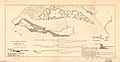
 Vicinity of Washington DC by Griffith Hopkins, 1894 (Jackson City detail crop).jpg 1,693 × 1,938; 867 KB
-
 Vicinity of Washington DC by Griffith Hopkins, 1894.jpg 18,600 × 18,600; 46.48 MB


.jpg)
