Category:1890s maps of Maine
States of the United States: Alabama · Alaska · Arizona · Arkansas · California · Colorado · Connecticut · Delaware · Florida · Georgia · Hawaii · Idaho · Illinois · Indiana · Iowa · Kansas · Kentucky · Louisiana · Maine · Maryland · Massachusetts · Michigan · Minnesota · Mississippi · Missouri · Montana · Nebraska · Nevada · New Hampshire · New Jersey · New Mexico · New York · North Carolina · North Dakota · Ohio · Oklahoma · Oregon · Pennsylvania · Rhode Island · South Carolina · South Dakota · Tennessee · Texas · Utah · Vermont · Virginia · Washington · West Virginia · Wisconsin · Wyoming – Washington, D.C.
Puerto Rico
Puerto Rico
Media in category "1890s maps of Maine"
The following 15 files are in this category, out of 15 total.
-
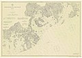 CrossIsland NashIsland 40000 1891 304-06-1891 chart.jpg 5,775 × 4,095; 8.47 MB
-
 The Pine-tree coast (1891) (14592096310).jpg 1,766 × 2,970; 373 KB
-
 FMIB 39486 Kames of Maine and Southeastern New Hampshire.jpeg 793 × 977; 164 KB
-

-
 1894 Colton Map of Maine - Geographicus - Maine-c-1894.jpg 3,000 × 3,682; 3.71 MB
-
 Maine 1894.jpg 4,749 × 5,756; 2.55 MB
-
 Map of Maine.jpg 2,939 × 3,550; 2.47 MB
-
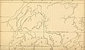
 397 of 'Elementary Physical Geography' (11300774486).jpg 1,391 × 1,243; 435 KB
-
 Our system of government (1896) (14742071036).jpg 3,484 × 2,064; 1.19 MB
-

-

-
 Maine Central Map 1898.jpg 3,871 × 2,266; 1.71 MB
-
 Map of northern Maine - specially adapted to the uses of lumbermen and sportsmen LOC 2010592713.jpg 13,416 × 14,247; 21.68 MB
-
 Map of northern Maine - specially adapted to the uses of lumbermen and sportsmen LOC 2010592713.tif 13,416 × 14,247; 546.85 MB
-


_(14592096310).jpg)

.jpg)


.jpg)
_(14742071036).jpg)
_(14773319491).jpg)
.jpg)


