Category:1890s maps of Puerto Rico
States of the United States: Alabama · Alaska · Arizona · Arkansas · California · Colorado · Connecticut · Delaware · Florida · Georgia · Hawaii · Idaho · Illinois · Indiana · Iowa · Kansas · Kentucky · Louisiana · Maine · Maryland · Massachusetts · Michigan · Minnesota · Mississippi · Missouri · Montana · Nebraska · Nevada · New Hampshire · New Jersey · New Mexico · New York · North Carolina · North Dakota · Ohio · Oklahoma · Oregon · Pennsylvania · Rhode Island · South Carolina · South Dakota · Tennessee · Texas · Utah · Vermont · Virginia · Washington · West Virginia · Wisconsin · Wyoming – Washington, D.C.
Puerto Rico
Puerto Rico
Media in category "1890s maps of Puerto Rico"
The following 31 files are in this category, out of 31 total.
-
 0633 001b.jpg 2,067 × 1,669; 1.97 MB
-

-

-

-

-
 311 of 'The War (of the United States) with Spain ... Illustrated' (11290791475).jpg 1,677 × 1,056; 371 KB
-
 364-7-? - NARA - 84786320.jpg 23,171 × 16,745; 18.7 MB
-

-
 Highways in Puerto Rico by 1898.jpg 5,033 × 2,177; 1.54 MB
-
 Map of porto rico.jpg 4,250 × 2,622; 5.33 MB
-
 Map of Puerto Rico showing distribution of crop lands. LOC 98687184.jpg 6,558 × 3,035; 3.27 MB
-
 Map of Puerto Rico showing distribution of crop lands. LOC 98687184.tif 6,558 × 3,035; 56.94 MB
-
 Map-of-Puerto-Rico-(1898).jpg 4,489 × 2,801; 5.61 MB
-
 Map-of-Puerto-Rico-(1899).jpg 5,630 × 3,632; 6.35 MB
-
 Map-of-Puerto-Rico-1898.jpg 3,840 × 3,099; 6.36 MB
-
 Military map, island of Puerto Rico.jpg 2,000 × 1,512; 2.43 MB
-
 Map of Porto Rico (Puerto Rico) (NYPL Hades-2314175-ps map 125).jpg 3,020 × 1,958; 5.21 MB
-
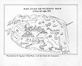
 Plan of San Juan (1892).jpg 1,976 × 1,497; 2.04 MB
-
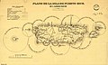 Plano de la Isla de Puerto Rico con el alumbrado maritimo, c. 1885.jpg 5,413 × 3,270; 672 KB
-
 Plano de la isla de Puerto-Rico, con el alumbrado maritimo. LOC 98687138.jpg 5,413 × 3,270; 2.44 MB
-
 Plano de la isla de Puerto-Rico, con el alumbrado maritimo. LOC 98687138.tif 5,413 × 3,270; 50.64 MB
-

-

-

-
 Ports and forts of San Juan.jpg 1,926 × 1,503; 568 KB
-
 Puerto-Rico---1897.jpg 3,075 × 1,267; 1.77 MB
-
 Riefkohl map.JPG 1,762 × 1,144; 1,018 KB
-
 Telegraph Lines and Stations in Porto Rico.jpg 948 × 458; 83 KB
-
 Telegraph-Lines---Puerto-Rico-1899.jpg 5,224 × 3,020; 2.6 MB
-

-


%27_(11252298253).jpg)
.jpg)
.jpg)
.jpg)
_with_Spain_..._Illustrated%27_(11290791475).jpg)

%27_(11250342294).jpg)


.jpg)
.jpg)


_(NYPL_Hades-2314175-ps_map_125).jpg)
.jpg)


_(14776616645).jpg)
_(14783196533).jpg)