Category:1870s maps of Maine
States of the United States: Alabama · Alaska · Arkansas · California · Colorado · Connecticut · Delaware · Florida · Georgia · Hawaii · Idaho · Illinois · Indiana · Iowa · Kansas · Kentucky · Louisiana · Maine · Maryland · Massachusetts · Michigan · Minnesota · Mississippi · Missouri · Montana · Nebraska · Nevada · New Hampshire · New Jersey · New Mexico · New York · North Carolina · North Dakota · Ohio · Oklahoma · Oregon · Pennsylvania · Rhode Island · South Carolina · South Dakota · Tennessee · Texas · Utah · Vermont · Virginia · Washington · West Virginia · Wyoming – Washington, D.C.
Puerto Rico
Puerto Rico
Media in category "1870s maps of Maine"
The following 7 files are in this category, out of 7 total.
-
 B&MLRR Belfast, ME Yard Map 1875.jpg 1,206 × 910; 1.14 MB
-
 Bird's eye view of the City of Bangor, Penobscot County, Maine, 1875 LOC 83694326.jpg 9,640 × 7,859; 14.75 MB
-
 Bird's eye view of the City of Bangor, Penobscot County, Maine, 1875 LOC 83694326.tif 9,640 × 7,859; 216.75 MB
-
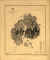
 Maine. LOC 99446178.jpg 5,278 × 6,372; 4.8 MB
-
 Maine. LOC 99446178.tif 5,278 × 6,372; 96.22 MB
-
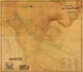
 Map of the village of Bucksport, Hancock County, Maine LOC 2007626396.jpg 11,664 × 10,104; 10.34 MB
-
 Map of the village of Bucksport, Hancock County, Maine LOC 2007626396.tif 11,664 × 10,104; 337.18 MB


