Category:1870s maps of Texas
States of the United States: Alabama · Alaska · Arkansas · California · Colorado · Connecticut · Delaware · Florida · Georgia · Hawaii · Idaho · Illinois · Indiana · Iowa · Kansas · Kentucky · Louisiana · Maine · Maryland · Massachusetts · Michigan · Minnesota · Mississippi · Missouri · Montana · Nebraska · Nevada · New Hampshire · New Jersey · New Mexico · New York · North Carolina · North Dakota · Ohio · Oklahoma · Oregon · Pennsylvania · Rhode Island · South Carolina · South Dakota · Tennessee · Texas · Utah · Vermont · Virginia · Washington · West Virginia · Wisconsin · Wyoming – Washington, D.C.
Puerto Rico
Puerto Rico
Subcategories
This category has the following 8 subcategories, out of 8 total.
- 1871 maps of Texas (1 F)
- 1872 maps of Texas (4 F)
- 1874 maps of Texas (5 F)
- 1875 maps of Texas (6 F)
- 1876 maps of Texas (18 F)
- 1877 maps of Texas (2 F)
- 1878 maps of Texas (5 F)
- 1879 maps of Texas (175 F)
Media in category "1870s maps of Texas"
The following 7 files are in this category, out of 7 total.
-
 "Texas New Yorker" travelers' railroad map of the State of Texas (11840363764).jpg 1,420 × 2,000; 2.87 MB
-
 1873 Map of Chisholm Trail with subsidiary trails in Texas.jpg 1,560 × 2,132; 2.41 MB
-

-
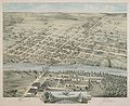
 Bird's eye view of the city of Denison, Texas, 1873 LOC 2013592367.jpg 8,296 × 6,593; 10.4 MB
-
 Bird's eye view of the city of Denison, Texas, 1873 LOC 2013592367.tif 8,296 × 6,593; 156.49 MB
-
 Brazoria County. LOC 2009583802.jpg 8,292 × 8,880; 8.59 MB
-
 Old map-Waco-1873.jpg 7,191 × 5,873; 17.78 MB
.jpg)

.jpg)


