Category:1870s maps of Maryland
States of the United States: Alabama · Alaska · Arkansas · California · Colorado · Connecticut · Delaware · Florida · Georgia · Hawaii · Idaho · Illinois · Indiana · Iowa · Kansas · Kentucky · Louisiana · Maine · Maryland · Massachusetts · Michigan · Minnesota · Mississippi · Missouri · Montana · Nebraska · Nevada · New Hampshire · New Jersey · New Mexico · New York · North Carolina · North Dakota · Ohio · Oklahoma · Oregon · Pennsylvania · Rhode Island · South Carolina · South Dakota · Tennessee · Texas · Utah · Vermont · Virginia · Washington · West Virginia · Wisconsin · Wyoming – Washington, D.C.
Puerto Rico
Puerto Rico
Subcategories
This category has the following 3 subcategories, out of 3 total.
Media in category "1870s maps of Maryland"
The following 11 files are in this category, out of 11 total.
-

-

-

-
 Gray's New Map of Rockville, Montgomery County, Maryland - NARA - 109186512.jpg 9,448 × 5,722; 2.76 MB
-
 Travilah MD 1878.png 494 × 808; 677 KB
-
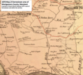 Darnestown - Hunting Hill 1878.png 844 × 759; 1.12 MB
-

-

-
 Map of Caroline County, Maryland LOC 2002628200.jpg 11,238 × 19,205; 23.04 MB
-
 Primary triangulation between the Maryland and Georgia base-lines (14724250564).jpg 2,000 × 1,521; 2.07 MB
-
 Talbot Co., Maryland. LOC 2012586804.jpg 6,525 × 5,629; 5.33 MB

%27_(11125061485).jpg)


.jpg)
