Category:1870s maps of Oregon
States of the United States: Alabama · Alaska · Arkansas · California · Colorado · Connecticut · Delaware · Florida · Georgia · Hawaii · Idaho · Illinois · Indiana · Iowa · Kansas · Kentucky · Louisiana · Maine · Maryland · Massachusetts · Michigan · Minnesota · Mississippi · Missouri · Montana · Nebraska · Nevada · New Hampshire · New Jersey · New Mexico · New York · North Carolina · North Dakota · Ohio · Oklahoma · Oregon · Pennsylvania · Rhode Island · South Carolina · South Dakota · Tennessee · Texas · Utah · Vermont · Virginia · Washington · West Virginia · Wyoming – Washington, D.C.
Puerto Rico
Puerto Rico
Subcategories
This category has the following 4 subcategories, out of 4 total.
- 1872 maps of Oregon (1 F)
- 1875 maps of Oregon (2 F)
- 1876 maps of Oregon (4 F)
- 1879 maps of Oregon (5 F)
Media in category "1870s maps of Oregon"
The following 5 files are in this category, out of 5 total.
-

-
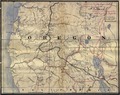 Map of Oregon traced in the Adjutant General's Office.tif 4,350 × 3,461; 43.07 MB
-
 1875 Gray Map of Washington and Oregon - Geographicus - WashingtonOregon-gray-1875.jpg 2,815 × 3,500; 3.4 MB
-

-
 Map of the fur country.png 3,148 × 1,965; 7.51 MB


