Category:1860s maps of Texas
States of the United States: Alabama · Alaska · Arizona · Arkansas · California · Colorado · Connecticut · Delaware · Florida · Georgia · Idaho · Illinois · Indiana · Iowa · Kansas · Kentucky · Louisiana · Maine · Maryland · Massachusetts · Michigan · Minnesota · Mississippi · Missouri · Montana · Nebraska · Nevada · New Hampshire · New Jersey · New Mexico · New York · North Carolina · North Dakota · Ohio · Oklahoma · Oregon · Pennsylvania · Rhode Island · South Carolina · South Dakota · Tennessee · Texas · Utah · Vermont · Virginia · Washington · West Virginia · Wisconsin · Wyoming – Washington, D.C.
Puerto Rico
Puerto Rico
Subcategories
This category has the following 4 subcategories, out of 4 total.
- 1861 maps of Texas (4 F)
- 1863 maps of Texas (4 F)
- 1865 maps of Texas (2 F)
- 1869 maps of Texas (empty)
Media in category "1860s maps of Texas"
The following 5 files are in this category, out of 5 total.
-
 Richardson's New Map of Texas including Part of Mexico 1861 UTA.jpg 1,800 × 1,357; 2.67 MB
-
 From U.S. Coast Survey Chart of the Gulf Coast of the United States - NARA - 122206749.jpg 6,856 × 5,897; 1.74 MB
-
 Pressler Traveller's Map of the State of Texas 1867 UTA.jpg 3,500 × 3,641; 3.74 MB
-

-
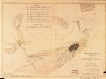 Galveston, Texas, showing the fortifications etc. LOC 86691333.tif 5,897 × 4,452; 75.11 MB


.jpg)