Category:1860s maps of Iowa
States of the United States: Alabama · Alaska · Arizona · Arkansas · California · Colorado · Connecticut · Delaware · Florida · Georgia · Idaho · Illinois · Indiana · Iowa · Kansas · Kentucky · Louisiana · Maine · Maryland · Massachusetts · Michigan · Minnesota · Mississippi · Missouri · Montana · Nebraska · Nevada · New Hampshire · New Jersey · New Mexico · New York · North Carolina · North Dakota · Ohio · Oklahoma · Oregon · Pennsylvania · Rhode Island · South Carolina · South Dakota · Tennessee · Texas · Utah · Vermont · Virginia · Washington · West Virginia · Wisconsin · Wyoming – Washington, D.C.
Puerto Rico
Puerto Rico
Subcategories
This category has the following 5 subcategories, out of 5 total.
- 1860 maps of Iowa (3 F)
- 1861 maps of Iowa (2 F)
- 1865 maps of Iowa (2 F)
- 1868 maps of Iowa (15 F)
- 1869 maps of Iowa (4 F)
Media in category "1860s maps of Iowa"
The following 7 files are in this category, out of 7 total.
-

-
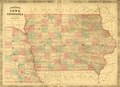
 1862 Johnson Map of Iowa and Nebraska - Geographicus - IANE-johnson-1862.jpg 3,000 × 2,201; 2.25 MB
-
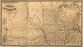
 1862 Galena & Chicago Union Railroad Map (IA 1862IowaRailroadMap).pdf 3,902 × 2,400; 3.85 MB
-
 1864 Iowa & Nebraska Map (IA 1864JohnsonMapOfIowaComplete).pdf 3,502 × 2,531; 16.99 MB
-
 1864 Mitchell Map of Iowa and Missouri - Geographicus - IAMO-mitchell-1864.jpg 3,261 × 4,000; 2.6 MB
-
 1869c Iowa Map Chicago Northwestern Railroad (IA 1869cIowaMapChicagoNorthwesternRailroad).pdf 29,752 × 17,062; 44.92 MB
-


.jpg)