Category:1860s maps of Colorado
States of the United States: Alabama · Alaska · Arizona · Arkansas · California · Colorado · Connecticut · Delaware · Florida · Georgia · Idaho · Illinois · Indiana · Iowa · Kansas · Kentucky · Louisiana · Maine · Maryland · Massachusetts · Michigan · Minnesota · Mississippi · Missouri · Montana · Nebraska · Nevada · New Hampshire · New Jersey · New Mexico · New York · North Carolina · North Dakota · Ohio · Oklahoma · Oregon · Pennsylvania · Rhode Island · South Carolina · South Dakota · Tennessee · Texas · Utah · Vermont · Virginia · Washington · West Virginia · Wisconsin · Wyoming – Washington, D.C.
Puerto Rico
Puerto Rico
Subcategories
This category has only the following subcategory.
D
Media in category "1860s maps of Colorado"
The following 37 files are in this category, out of 37 total.
-

-
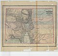
 Map of Colorado Territory - NARA - 23812162.jpg 6,880 × 5,650; 2.68 MB
-

-
-
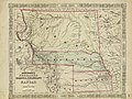
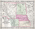
 1862 Johnson Map of Kansas, Nebraska and Dakota - Geographicus - NEKADK-johnson-1862.jpg 4,000 × 3,238; 4.44 MB
-

-
 Johnson's Nebraska, Dakota, Colorado & Kansas - DPLA - 8a8b41c015afe2f6d95877fa12c5e3e4.jpg 8,015 × 6,004; 8.04 MB
-

-
 Map of Colorado territory - DPLA - 6ea34cef6a88cc61cf7df08c978f79c6.jpg 7,000 × 5,201; 4.65 MB
-
-

-
 Map of Colorado Territory Embracing the Central Gold Region - NARA - 6860677.jpg 3,150 × 3,006; 4.51 MB
-
 Map of Colorado Territory embracing the Central Gold Region LOC 2003630493.jpg 10,946 × 9,689; 16.11 MB
-
 Map of Colorado Territory embracing the Central Gold Region LOC 2003630493.tif 10,946 × 9,689; 303.43 MB
-

-

-

-

-

-

-
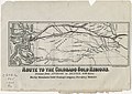 Route to the Colorado gold regions - DPLA - 46e32de95e50c374f33d3d8735411ca0.jpg 8,000 × 5,663; 4.58 MB
-
 1864 Mitchell Map of Colorado, Kansas ^ Nebraska - Geographicus - COKANE-mitchell-1864.jpg 4,000 × 3,292; 2.32 MB
-

-
-
-
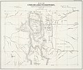
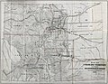
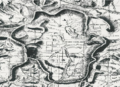
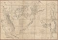
 Map of Colorado Territory, Showing the System of Parks - NARA - 23812226.jpg 6,816 × 5,829; 3.37 MB
-

-

-
 Map of Colorado Territory, United States - DPLA - 6f1933128ed8b5cb38084a2e7ae991d7.jpg 8,004 × 5,981; 9.51 MB
-

-
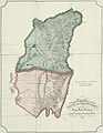
 1869 Map of San Luis Parc of Colorado and Northern New Mexico.png 482 × 351; 344 KB
-
 Map of Colorado Territory - DPLA - 932ef8c896be1de660571df98784ed2f.jpg 8,007 × 6,129; 4.61 MB
-
-
 COCANE-j-64.jpg 600 × 490; 167 KB
-
 Colorado Territory in 1861, showing acquisitions.png 834 × 530; 614 KB
-
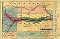 Kansaspacificgrants.jpg 5,304 × 3,497; 2.71 MB
-
 Territory and military department of Utah LOC 2015591071.jpg 12,806 × 8,733; 15.9 MB


.jpg)
.jpg)


_the_system_of_parks_-_DPLA_-_83dead53320d1c87fa55b9669b4721e5.jpg)


