Category:1860s maps of North Carolina
States of the United States: Alabama · Alaska · Arizona · Arkansas · California · Colorado · Connecticut · Delaware · Florida · Georgia · Idaho · Illinois · Indiana · Iowa · Kansas · Kentucky · Louisiana · Maine · Maryland · Massachusetts · Michigan · Minnesota · Mississippi · Missouri · Montana · Nebraska · Nevada · New Hampshire · New Jersey · New Mexico · New York · North Carolina · North Dakota · Ohio · Oklahoma · Oregon · Pennsylvania · Rhode Island · South Carolina · South Dakota · Tennessee · Texas · Utah · Vermont · Virginia · Washington · West Virginia · Wisconsin · Wyoming – Washington, D.C.
Puerto Rico
Puerto Rico
Subcategories
This category has the following 5 subcategories, out of 5 total.
- 1861 maps of North Carolina (6 F)
- 1862 maps of North Carolina (12 F)
- 1864 maps of North Carolina (19 F)
Media in category "1860s maps of North Carolina"
The following 9 files are in this category, out of 9 total.
-

-

-

-
-
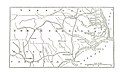
 Map of eastern Virginia and North Carolina from the United States Coast Survey LOC lva0000029.tif 7,206 × 8,987; 185.28 MB
-
 Map of Mosby's route through Virginia and North Carolina. LOC gvhs01.vhs00176.jpg 3,204 × 2,278; 1.85 MB
-
 Map of New Berne, N.C., and Defenses, 1864.png 828 × 796; 1.34 MB
-
 Military maps of the United States. LOC 2009581117-14.jpg 5,277 × 3,705; 1.67 MB
-
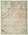
 Mountain region of North Carolina and Tennessee LOC 99447120.jpg 11,754 × 6,687; 16.42 MB
_and_North_Carolina_-_Geographicus_-_VANC-mitchell-1860.jpg)
.jpg)
.jpg)


_F.P%27_(11074200354).jpg)