Category:1860s maps of New Jersey
States of the United States: Alabama · Alaska · Arizona · Arkansas · California · Colorado · Connecticut · Delaware · Florida · Georgia · Idaho · Illinois · Indiana · Iowa · Kansas · Kentucky · Louisiana · Maine · Maryland · Massachusetts · Michigan · Minnesota · Mississippi · Missouri · Montana · Nebraska · Nevada · New Hampshire · New Jersey · New Mexico · New York · North Carolina · North Dakota · Ohio · Oklahoma · Oregon · Pennsylvania · Rhode Island · South Carolina · South Dakota · Tennessee · Texas · Utah · Vermont · Virginia · Washington · West Virginia · Wisconsin · Wyoming – Washington, D.C.
Puerto Rico
Puerto Rico
Media in category "1860s maps of New Jersey"
The following 16 files are in this category, out of 16 total.
-
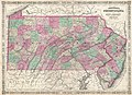
 (Map of Pennsylvania and part of New Jersey). LOC 2005625064.jpg 21,267 × 11,470; 34.06 MB
-
 (Map of Pennsylvania and part of New Jersey). LOC 2005625064.tif 21,267 × 11,470; 697.9 MB
-
 1862 Johnson Map of New Jersey - Geographicus - NJ-johnson-1862.jpg 2,500 × 3,065; 2.49 MB
-

-
-

-
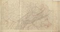
 Map of British Military Operations in New York and New Jersey in 1776 (6 MB).jpg 1,846 × 2,559; 5.27 MB
-
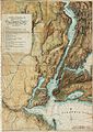
 Map of British Military Operations in New York and New Jersey in 1776 (73 MB).jpg 7,510 × 10,412; 69.28 MB
-
-

-
 1868 Colton Map of New Jersey - Geographicus - NJ-colton-1868.jpg 3,359 × 5,000; 5.86 MB
-

-
 CamdenAmboy Map 1869.jpg 656 × 907; 253 KB
-

-
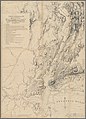
 Map of Cumberland Co., New Jersey - from actual surveys LOC 2010592714.jpg 16,806 × 18,300; 30.53 MB
-
 Map of the settled parts of the Vineland tract LOC 2012593524.jpg 13,383 × 11,281; 23.24 MB
._LOC_2005625064.jpg)


.jpg)
.jpg)


_(14784992605).jpg)

_(14572285230).jpg)

