Category:1860s maps of New York (state)
States of the United States: Alabama · Alaska · Arizona · Arkansas · California · Colorado · Connecticut · Delaware · Florida · Georgia · Idaho · Illinois · Indiana · Iowa · Kansas · Kentucky · Louisiana · Maine · Maryland · Massachusetts · Michigan · Minnesota · Mississippi · Missouri · Montana · Nebraska · Nevada · New Hampshire · New Jersey · New Mexico · New York · North Carolina · North Dakota · Ohio · Oklahoma · Oregon · Pennsylvania · Rhode Island · South Carolina · South Dakota · Tennessee · Texas · Utah · Vermont · Virginia · Washington · West Virginia · Wisconsin · Wyoming – Washington, D.C.
Puerto Rico
Puerto Rico
Subcategories
This category has the following 9 subcategories, out of 9 total.
- 1864 maps of New York (state) (20 F)
N
Media in category "1860s maps of New York (state)"
The following 3 files are in this category, out of 3 total.
-
-
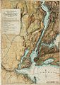
 Map of British Military Operations in New York and New Jersey in 1776 (6 MB).jpg 1,846 × 2,559; 5.27 MB
-
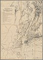 Map of British Military Operations in New York and New Jersey in 1776 (73 MB).jpg 7,510 × 10,412; 69.28 MB

.jpg)
.jpg)