Category:1810s maps of New York (state)
States of the United States: Alabama · Arizona · Arkansas · California · Delaware · Florida · Georgia · Illinois · Indiana · Iowa · Kentucky · Louisiana · Maine · Maryland · Massachusetts · Michigan · Mississippi · Missouri · New Hampshire · New Jersey · New Mexico · New York · North Carolina · Ohio · Oregon · Pennsylvania · Rhode Island · South Carolina · Tennessee · Texas · Virginia – Washington, D.C.
Puerto Rico
Puerto Rico
Subcategories
This category has the following 3 subcategories, out of 3 total.
B
N
- 1810s maps of New York City (5 F)
Media in category "1810s maps of New York (state)"
The following 11 files are in this category, out of 11 total.
-
 Hand Drawn Map of Rochester, 1811.jpg 3,264 × 2,448; 1.95 MB
-

-
 State of New-York for Spafford's gazetteer LOC 2011587198.jpg 4,482 × 3,479; 2.16 MB
-
 State of New-York for Spafford's gazetteer LOC 2011587198.tif 4,482 × 3,479; 44.61 MB
-
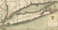 Long Island 1815.png 1,372 × 726; 2.63 MB
-

-
 New York and adjacent country. NYPL433876.tiff 2,320 × 2,802; 18.6 MB
-
 Niagra River and Territory, 1812.jpg 1,473 × 2,305; 550 KB
-
 The state of New York (2674713970).jpg 2,000 × 1,555; 2.62 MB
-
 Tuscarora Reservation.jpg 2,988 × 5,312; 4.83 MB
-
 Views of Old-Time Buffalo p30 b.jpg 2,200 × 3,682; 1.27 MB


.jpg)

