Category:1810s maps of Florida
States of the United States: Alabama · Arizona · Arkansas · California · Delaware · Florida · Georgia · Illinois · Indiana · Iowa · Kentucky · Louisiana · Maine · Maryland · Massachusetts · Michigan · Mississippi · Missouri · New Hampshire · New Jersey · New Mexico · New York · North Carolina · Ohio · Oregon · Pennsylvania · Rhode Island · South Carolina · Tennessee · Texas · Vermont · Virginia – Washington, D.C.
Puerto Rico
Puerto Rico
Subcategories
This category has the following 2 subcategories, out of 2 total.
- 1811 maps of Florida (1 F)
- 1815 maps of Florida (6 F)
Media in category "1810s maps of Florida"
The following 3 files are in this category, out of 3 total.
-
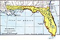 Map of East and West Florida in 1819.jpg 632 × 420; 148 KB
-
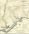 Map of the Forbes Purchase (9124181511).jpg 1,000 × 1,194; 1.41 MB
-
 Westfloridaitsre00cham 0010.jpg 2,616 × 1,920; 456 KB

.jpg)
