Category:1810s maps of Delaware
States of the United States: Alabama · Arizona · Arkansas · California · Delaware · Florida · Georgia · Illinois · Indiana · Iowa · Kentucky · Louisiana · Maine · Maryland · Massachusetts · Michigan · Mississippi · Missouri · New Hampshire · New Jersey · New Mexico · New York · North Carolina · Ohio · Oregon · Pennsylvania · Rhode Island · South Carolina · Tennessee · Texas · Virginia – Washington, D.C.
Puerto Rico
Puerto Rico
Media in category "1810s maps of Delaware"
The following 3 files are in this category, out of 3 total.
-
 A new and accurate chart of the Bay of Chesapeak including Delaware Bay (3046378650).jpg 1,607 × 2,000; 3.1 MB
-
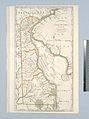
 Delaware LOC 2018590119.jpg 2,136 × 2,469; 692 KB
-
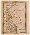
 Delaware, from the best authorities (NYPL b15369810-434456).jpg 3,656 × 4,900; 3.45 MB
.jpg)

.jpg)