Category:1860s maps of Rhode Island
States of the United States: Alabama · Alaska · Arizona · Arkansas · California · Colorado · Connecticut · Delaware · Florida · Georgia · Idaho · Illinois · Indiana · Iowa · Kansas · Kentucky · Louisiana · Maine · Maryland · Massachusetts · Michigan · Minnesota · Mississippi · Missouri · Montana · Nebraska · Nevada · New Hampshire · New Jersey · New Mexico · New York · North Carolina · North Dakota · Ohio · Oklahoma · Oregon · Pennsylvania · Rhode Island · South Carolina · South Dakota · Tennessee · Texas · Utah · Vermont · Virginia · Washington · West Virginia · Wisconsin · Wyoming – Washington, D.C.
Puerto Rico
Puerto Rico
Media in category "1860s maps of Rhode Island"
The following 11 files are in this category, out of 11 total.
-
 1860 Shore Line Railroad.jpg 6,806 × 5,517; 10.04 MB
-

-

-

-
-

-

-

-

-
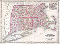
 Johnsons Massachusetts Connecticut and Rhode Island (7537856132).jpg 2,000 × 1,384; 3.12 MB
-
 Rhode Island Presidential Election Results 1868.svg 810 × 810; 13 KB


_-_Geographicus_-_VTNHMACTRI-j-64.jpg)


.jpg)
