Category:1820s maps of Rhode Island
States of the United States: Alabama · Alaska · Delaware · Florida · Georgia · Hawaii · Illinois · Indiana · Kentucky · Louisiana · Maine · Maryland · Massachusetts · Michigan · Mississippi · Missouri · New Hampshire · New Jersey · New York · Ohio · Pennsylvania · Rhode Island · South Carolina · South Dakota · Tennessee · Utah · Vermont · Virginia
Subcategories
This category has the following 2 subcategories, out of 2 total.
- 1822 maps of Rhode Island (1 F)
- 1829 maps of Rhode Island (2 F)
Media in category "1820s maps of Rhode Island"
This category contains only the following file.
-
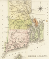 1822 map Rhode Island byLucasFielding BPL 14937.png 624 × 746; 747 KB
