Category:1860s maps of Washington, D.C.
States of the United States: Alabama · Alaska · Arizona · Arkansas · California · Colorado · Connecticut · Delaware · Florida · Georgia · Idaho · Illinois · Indiana · Iowa · Kansas · Kentucky · Louisiana · Maine · Maryland · Massachusetts · Michigan · Minnesota · Mississippi · Missouri · Montana · Nebraska · Nevada · New Hampshire · New Jersey · New Mexico · New York · North Carolina · North Dakota · Ohio · Oklahoma · Oregon · Pennsylvania · Rhode Island · South Carolina · South Dakota · Tennessee · Texas · Utah · Vermont · Virginia · Washington · West Virginia · Wisconsin · Wyoming – Washington, D.C.
Puerto Rico
Puerto Rico
Subcategories
This category has the following 6 subcategories, out of 6 total.
- 1860 maps of Washington, D.C. (10 F)
- 1863 maps of Washington, D.C. (15 F)
- 1865 maps of Washington, D.C. (10 F)
- 1867 maps of Washington, D.C. (14 F)
Media in category "1860s maps of Washington, D.C."
The following 25 files are in this category, out of 25 total.
-

-

-
 1862 Johnson Map of Maryland and Delaware - Geographicus - MDDE-johnson-1862.jpg 4,000 × 3,176; 3.91 MB
-
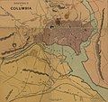
 1862 Johnson Map of Washington D.C. and Georgetown - Geographicus - WashDC-johnson-1862.jpg 4,000 × 3,249; 4.16 MB
-
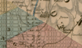 Eckington Hospital (Detail from 1862 map).png 1,134 × 658; 1.91 MB
-
 1866 Johnson Map of Washington D.C. - Geographicus - WashingtonDC-johnson-1866.jpg 3,500 × 2,816; 3.19 MB
-

-
-

-
 Dc-defenses-1864-925.jpg 2,629 × 2,409; 1.3 MB
-

-
 Fort Pennsylvania and encampment at Tennallytown near Washington, D.C. LOC 00552388.jpg 6,516 × 3,820; 2.49 MB
-
 Fort Pennsylvania and encampment at Tennallytown near Washington, D.C. LOC 00552388.tif 6,516 × 3,820; 71.21 MB
-

-
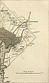 History of the American Civil War (1867) (14762364862).jpg 1,532 × 2,568; 409 KB
-
 History of the American Civil War (1867) (14782557933).jpg 1,528 × 2,540; 610 KB
-

-

-

-

-

-

-

-
 Johnson's Washington and Georgetown. LOC 88693493.jpg 5,545 × 4,474; 4.15 MB
-


.png)

.jpg)
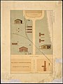
,_Washington,_D.C._(Ground_plan_and_views.)_-_NARA_-_305819.jpg)
_(1885)_(14591061689).jpg)

.jpg)

.jpg)
_(14762364862).jpg)
_(14782557933).jpg)
_(14576102108).jpg)


.jpg)