Category:1860s maps of West Virginia
States of the United States: Alabama · Alaska · Arizona · Arkansas · California · Colorado · Connecticut · Delaware · Florida · Georgia · Idaho · Illinois · Indiana · Iowa · Kansas · Kentucky · Louisiana · Maine · Maryland · Massachusetts · Michigan · Minnesota · Mississippi · Missouri · Montana · Nebraska · Nevada · New Hampshire · New Jersey · New Mexico · New York · North Carolina · North Dakota · Ohio · Oklahoma · Oregon · Pennsylvania · Rhode Island · South Carolina · South Dakota · Tennessee · Texas · Utah · Vermont · Virginia · Washington · West Virginia · Wisconsin · Wyoming – Washington, D.C.
Puerto Rico
Puerto Rico
Subcategories
This category has the following 4 subcategories, out of 4 total.
- 1861 maps of West Virginia (10 F)
- 1862 maps of West Virginia (14 F)
- 1863 maps of West Virginia (7 F)
- 1864 maps of West Virginia (12 F)
Media in category "1860s maps of West Virginia"
The following 34 files are in this category, out of 34 total.
-
 (Map of area in the vicinity of Berkeley Springs.) - NARA - 305611.tif 3,900 × 2,384; 26.6 MB
-
 Cox Situation May 1862.png 933 × 774; 1.35 MB
-
 Crooks situation - Battle of Lewisburg.png 874 × 618; 978 KB
-
 Heth Moves - Battle of Lewisburg.png 659 × 765; 858 KB
-
 Kanawha Campaign.png 464 × 637; 683 KB
-
 Kanawha River Valley and Fayetteville.png 700 × 768; 1.05 MB
-
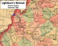
 Lightburns Retreat September 1862.JPG 585 × 620; 99 KB
-
 Sinking Creek Raid Map 2.JPG 661 × 466; 105 KB
-
 Sinking Creek Raid Map 3.JPG 884 × 603; 171 KB
-
 Warrenton Junction VA map.jpg 423 × 223; 56 KB
-
 LightburnEscapesToOhio.png 869 × 674; 1.18 MB
-
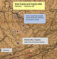
 Approach to Wytheville 2 1863.JPG 683 × 306; 68 KB
-
 Harper's Ferry (1863) LOC 99448910.jpg 8,609 × 7,150; 13.64 MB
-
 Lewisburg 1863.png 698 × 749; 1.08 MB
-
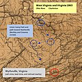
 Union Approach to Wytheville 1863.JPG 523 × 542; 101 KB
-
 WVA - VA - MD - PA 1863.png 970 × 620; 1.49 MB
-
 Wytheville Raid 1863.png 452 × 748; 675 KB
-
 Wytheville Raid Map.JPG 587 × 589; 120 KB
-
 Map Kanawha Valley 2nd WVA Cavalry.PNG 737 × 735; 1.34 MB
-
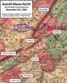 Averell Moves North.png 485 × 596; 711 KB
-
 Averell Return Salem Raid.png 566 × 784; 923 KB
-
 Kanawha River and Nearby Counties.png 671 × 676; 1,018 KB
-
 Prelude to Battle of White Sulphur Springs Aug 24.png 929 × 693; 1.32 MB
-
 Prelude to Battle of White Sulphur Springs.png 837 × 614; 1.09 MB
-
 Prime Recruiting Area for 1st West Virginia Cavalry.png 581 × 601; 1.01 MB
-
 Retreat From Droop Mountain.png 505 × 595; 565 KB
-
 Retreat from Droop Mtn 11-7-1863.png 509 × 606; 601 KB
-
 Union Army Raid Lewisburg Nov 1.png 732 × 729; 1.25 MB
-
 Lightburns Retreat.png 890 × 705; 1.39 MB
-
 Virginia 1864.png 1,159 × 706; 1.7 MB
-
 Custer at Dinwiddie Court House.JPG 580 × 317; 60 KB
-
 Gettysburg to Williamsport.png 959 × 721; 1.56 MB
-

-


_LOC_99448910.jpg)


.jpg)