Category:1830s maps of Massachusetts
States of the United States: Alabama · Alaska · Arizona · Arkansas · California · Connecticut · Delaware · Florida · Georgia · Hawaii · Illinois · Indiana · Iowa · Kansas · Kentucky · Louisiana · Maine · Maryland · Massachusetts · Michigan · Mississippi · Missouri · Nebraska · Nevada · New Hampshire · New Jersey · New York · Ohio · Oklahoma · Pennsylvania · Rhode Island · South Carolina · Tennessee · Texas · Utah · Vermont · Virginia
Puerto Rico
Puerto Rico
Subcategories
This category has the following 11 subcategories, out of 11 total.
- 1831 maps of Massachusetts (10 F)
- 1832 maps of Massachusetts (10 F)
- 1833 maps of Massachusetts (5 F)
- 1836 maps of Massachusetts (10 F)
- 1837 maps of Massachusetts (5 F)
- 1839 maps of Massachusetts (5 F)
B
Media in category "1830s maps of Massachusetts"
The following 5 files are in this category, out of 5 total.
-
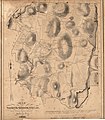 Map of North-Brookfield LOC 2003620494.jpg 5,254 × 6,027; 5.39 MB
-
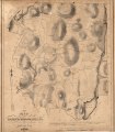 Map of North-Brookfield LOC 2003620494.tif 5,254 × 6,027; 90.6 MB
-
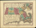 Massachusetts (2674963776).jpg 2,000 × 1,542; 2.94 MB
-
 Massachusetts with Connecticut and Rhode Island (8346560987).jpg 800 × 619; 151 KB
-
 Plan of the village in old Cambridge,1833.tif 13,995 × 10,634; 425.8 MB

.jpg)
.jpg)