Category:1830s maps of Alabama
States of the United States: Alabama · Alaska · Arizona · Arkansas · California · Colorado · Connecticut · Delaware · Florida · Georgia · Illinois · Indiana · Iowa · Kansas · Kentucky · Louisiana · Maine · Maryland · Massachusetts · Michigan · Minnesota · Mississippi · Missouri · Montana · Nebraska · Nevada · New Hampshire · New Jersey · New Mexico · New York · North Carolina · North Dakota · Ohio · Oklahoma · Oregon · Pennsylvania · Rhode Island · South Carolina · South Dakota · Tennessee · Texas · Utah · Vermont · Virginia · Washington · Wisconsin · Wyoming – Washington, D.C.
Puerto Rico
Puerto Rico
Media in category "1830s maps of Alabama"
The following 10 files are in this category, out of 10 total.
-
 1833 Map of Alabama counties.jpeg 3,542 × 4,653; 1.58 MB
-
 1838 Map of Alabama counties.jpeg 3,430 × 4,427; 1.47 MB
-

-

-

-

-
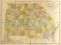 Map of Georgia and Alabama WDL9597.png 1,374 × 1,024; 2.47 MB
-

-

-
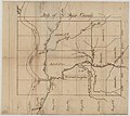 Map of Dyer County, Tennessee (1836).jpg 7,200 × 6,423; 3.24 MB


,_Geographer_to_the_House_of_Representatives_of_the_LOC_98688462.jpg)
.jpg)
.jpg)


.jpg)