Category:1850s maps of Missouri
States of the United States: Alabama · Alaska · Arizona · Arkansas · California · Colorado · Connecticut · Delaware · Florida · Georgia · Illinois · Indiana · Iowa · Kansas · Kentucky · Louisiana · Maine · Maryland · Massachusetts · Michigan · Minnesota · Mississippi · Missouri · Montana · Nebraska · Nevada · New Hampshire · New Jersey · New Mexico · New York · North Carolina · North Dakota · Ohio · Oklahoma · Oregon · Pennsylvania · Rhode Island · South Carolina · South Dakota · Tennessee · Texas · Utah · Vermont · Virginia · Washington · Wisconsin · Wyoming – Washington, D.C.
Puerto Rico
Puerto Rico
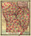
Media in category "1850s maps of Missouri"
The following 6 files are in this category, out of 6 total.
-
 1850 Western District of Columbia.jpg 852 × 1,513; 365 KB
-

-

-
 1859 Iowa Railroad Map (IA 1859IowaRailroadMap).pdf 14,372 × 16,608; 26.91 MB
-
 New map of the state of Missouri. LOC 2012593322 (cropped).jpg 4,890 × 3,970; 4.09 MB
-
 New map of the state of Missouri. LOC 2012593322.jpg 5,964 × 3,970; 4.55 MB


.jpg)
.jpg)
