Category:1850s maps of Louisiana
States of the United States: Alabama · Alaska · Arizona · Arkansas · California · Colorado · Connecticut · Delaware · Florida · Georgia · Illinois · Indiana · Iowa · Kansas · Kentucky · Louisiana · Maine · Maryland · Massachusetts · Michigan · Minnesota · Mississippi · Missouri · Montana · Nebraska · Nevada · New Hampshire · New Jersey · New Mexico · New York · North Carolina · North Dakota · Ohio · Oklahoma · Oregon · Pennsylvania · Rhode Island · South Carolina · South Dakota · Tennessee · Texas · Utah · Vermont · Virginia · Washington · Wisconsin · Wyoming – Washington, D.C.
Puerto Rico
Puerto Rico
Subcategories
This category has the following 5 subcategories, out of 5 total.
- 1852 maps of Louisiana (1 F)
- 1853 maps of Louisiana (4 F)
- 1855 maps of Louisiana (5 F)
- 1858 maps of Louisiana (3 F)
N
- 1850s maps of New Orleans (6 F)
Media in category "1850s maps of Louisiana"
The following 6 files are in this category, out of 6 total.
-
 Meyer‘s Zeitungsatlas 067 – Die Staaten von Arkansas, Mississippi, Louisiana und Alabama.jpg 7,420 × 6,224; 11.1 MB
-

-
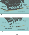 Isles Dernieres.gif 481 × 576; 23 KB
-
 LastIsland1853.jpg 459 × 212; 76 KB
-

-
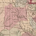 Saint Landry St Landre Parish 1856 from Colton's Louisiana LOC 2010592397.jpg 1,006 × 1,006; 453 KB


