Category:1830s maps of Indiana
States of the United States: Alabama · Alaska · Arizona · Arkansas · California · Connecticut · Delaware · Florida · Georgia · Hawaii · Illinois · Indiana · Iowa · Kansas · Kentucky · Louisiana · Maine · Maryland · Massachusetts · Michigan · Mississippi · Missouri · Nebraska · Nevada · New Hampshire · New Jersey · New York · Ohio · Oklahoma · Pennsylvania · Rhode Island · South Carolina · Tennessee · Texas · Utah · Vermont · Virginia
Puerto Rico
Puerto Rico
Subcategories
This category has the following 3 subcategories, out of 3 total.
- 1831 maps of Indiana (1 F)
- 1836 maps of Indiana (2 F)
- 1839 maps of Indiana (5 F)
Media in category "1830s maps of Indiana"
The following 4 files are in this category, out of 4 total.
-
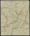 Indian campaign of 1832- map of the country (IA ruggles 408).pdf 743 × 900, 2 pages; 156 KB
-
-
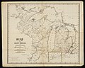 800-c-Reg4-B-1836b.jpg 6,958 × 5,582; 8.37 MB
-

.jpg)

