Category:1990s maps of California
States of the United States: Alabama · Alaska · Arizona · Arkansas · California · Colorado · Delaware · Florida · Georgia · Hawaii · Kentucky · Louisiana · Maine · Maryland · Massachusetts · Mississippi · Nebraska · New Hampshire · New Jersey · New York · North Carolina · Ohio · Pennsylvania · Rhode Island · South Carolina · South Dakota · Tennessee · Texas · Utah · Vermont · Virginia · West Virginia – Washington, D.C.
Subcategories
This category has the following 4 subcategories, out of 4 total.
- 1995 maps of California (1 F)
- 1998 maps of California (1 F)
- 1999 maps of California (3 F)
S
- 1990s maps of San Francisco (26 F)
Media in category "1990s maps of California"
This category contains only the following file.
-
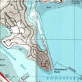 Aramburu Island, USGS, 1999.png 582 × 582; 642 KB
