Category:1907 maps of Ohio
States of the United States: Alaska · California · Idaho · Illinois · Iowa · Kansas · Massachusetts · Michigan · Minnesota · Mississippi · Missouri · Nebraska · Nevada · New York · North Dakota · Ohio · Pennsylvania · Texas · Utah · Wisconsin · Wyoming – Washington, D.C.
| ← 1900 1902 1904 1905 1906 1907 1908 1909 → |
Subcategories
This category has only the following subcategory.
Media in category "1907 maps of Ohio"
The following 5 files are in this category, out of 5 total.
-
 Cleveland railroads 1907.jpg 2,399 × 1,678; 749 KB
-
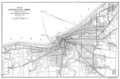 Map of Cleveland Ohio showing the lines of the Cleveland Electric Railway Company c 1907.png 1,978 × 1,298; 1.74 MB
-
 Map of Cleveland-Southwestern and Columbus Railway c 1907.png 1,290 × 1,072; 1.37 MB
-
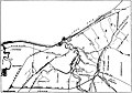
 Map Showing the Line of the Conneaut and Erie Traction Company c 1907.png 1,316 × 802; 718 KB
-
 Ohio railroads historical map, 1907 - DPLA - 58e9aa9e43474aa1461bd49bccc00365.jpg 7,870 × 9,000; 12.92 MB


