Category:1908 maps of Ohio
States of the United States: Alaska · California · Georgia · Idaho · Illinois · Iowa · Louisiana · Maryland · Massachusetts · Michigan · Minnesota · Missouri · Nebraska · Nevada · New York · North Dakota · Ohio · Pennsylvania · South Dakota · Texas · Utah · Virginia · West Virginia · Wisconsin
| ← 1900 1902 1904 1905 1906 1907 1908 1909 → |
Media in category "1908 maps of Ohio"
The following 4 files are in this category, out of 4 total.
-
 Map of Cleveland and Vicinity (1908) - DPLA - dbb4526c9731881360bb8d397abd0863.jpg 5,305 × 3,672; 2.42 MB
-

-
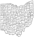 PSM V72 D046 Tenant farmers of ohio based on the 12th census of 1900.png 1,639 × 1,784; 372 KB
-
 PSM V72 D047 Farm acreage of ohio by county based on the 12th census of 1900.png 1,675 × 1,789; 425 KB
_-_DPLA_-_dbb4526c9731881360bb8d397abd0863.jpg)
.jpg)

