Category:1908 maps of Michigan
States of the United States: Alaska · California · Georgia · Idaho · Illinois · Iowa · Louisiana · Maryland · Massachusetts · Michigan · Minnesota · Missouri · Nebraska · Nevada · New York · North Dakota · Ohio · Pennsylvania · South Dakota · Texas · Utah · Virginia · West Virginia · Wisconsin
| ← 1900 1901 1902 1903 1904 1906 1907 1908 1909 → |
Subcategories
This category has the following 10 subcategories, out of 10 total.
S
Media in category "1908 maps of Michigan"
The following 6 files are in this category, out of 6 total.
-
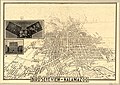 Bird's-eye view of Kalamazoo LOC 89692605.jpg 11,374 × 8,021; 18.39 MB
-
 Sanborn Fire Insurance Map from Coleman, Midland County, Michigan. LOC sanborn03969 002.jpg 6,510 × 7,707; 3.88 MB
-

-
 Sanborn Fire Insurance Map from Farwell, Clare County, Michigan. LOC sanborn04004 003.jpg 6,522 × 7,683; 3.89 MB
-
 Sanborn Fire Insurance Map from Linden, Genesee County, Michigan. LOC sanborn04080 003.jpg 6,510 × 7,707; 3.37 MB
-


