Category:1910s maps of Michigan
States of the United States: Alabama · Alaska · Arizona · Arkansas · California · Colorado · Connecticut · Delaware · Florida · Georgia · Hawaii · Idaho · Illinois · Indiana · Iowa · Kansas · Kentucky · Louisiana · Maine · Maryland · Massachusetts · Michigan · Minnesota · Mississippi · Missouri · Montana · Nebraska · Nevada · New Hampshire · New Jersey · New Mexico · New York · North Carolina · North Dakota · Ohio · Oklahoma · Oregon · Pennsylvania · Rhode Island · South Carolina · South Dakota · Tennessee · Texas · Utah · Vermont · Virginia · Washington · West Virginia · Wisconsin · Wyoming – Washington, D.C.
Puerto Rico
Puerto Rico
Subcategories
This category has the following 11 subcategories, out of 11 total.
D
Media in category "1910s maps of Michigan"
The following 2 files are in this category, out of 2 total.
-
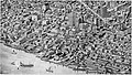
 Electric railway journal (1910) (14574235388).jpg 2,981 × 2,302; 1.04 MB
-
 Detroit 1908 Hurd-Martin 1907.jpeg 4,810 × 2,717; 3.44 MB
_(14574235388).jpg)
