Category:1910s maps of Oklahoma
States of the United States: Alabama · Alaska · Arizona · Arkansas · California · Colorado · Connecticut · Delaware · Florida · Georgia · Hawaii · Idaho · Illinois · Indiana · Iowa · Kansas · Kentucky · Louisiana · Maine · Maryland · Massachusetts · Michigan · Minnesota · Mississippi · Missouri · Montana · Nebraska · Nevada · New Hampshire · New Jersey · New Mexico · New York · North Carolina · North Dakota · Ohio · Oklahoma · Oregon · Pennsylvania · Rhode Island · South Carolina · South Dakota · Tennessee · Texas · Utah · Vermont · Virginia · Washington · West Virginia · Wisconsin · Wyoming – Washington, D.C.
Puerto Rico
Puerto Rico
[[Category:Maps of Oklahoma by decade| 1910s}}
Subcategories
This category has the following 6 subcategories, out of 6 total.
- 1911 maps of Oklahoma (7 F)
- 1917 maps of Oklahoma (1 F)
Media in category "1910s maps of Oklahoma"
This category contains only the following file.
-
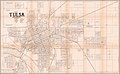 1915 map of Tulsa, Oklahoma.jpg 20,839 × 12,880; 55.79 MB
