Category:1910s maps of Syria
Countries of Asia: Afghanistan · Armenia‡ · Azerbaijan‡ · Cambodia · People's Republic of China · Cyprus‡ · Egypt‡ · Georgia‡ · India · Indonesia‡ · Iran · Iraq · Japan · Jordan · Lebanon · Myanmar · Philippines · Russia‡ · Syria · Turkey‡
Limited recognition: Abkhazia‡ · Taiwan · State of Palestine
‡: partly located in Asia
Limited recognition: Abkhazia‡ · Taiwan · State of Palestine
‡: partly located in Asia
Subcategories
This category has the following 3 subcategories, out of 3 total.
- 1911 maps of Syria (1 F)
- 1915 maps of Syria (1 F)
- 1917 maps of Syria (empty)
Media in category "1910s maps of Syria"
The following 13 files are in this category, out of 13 total.
-
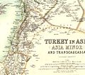 W. & A.K. Johnston. Asia Minor. 1911 DA.jpg 1,482 × 1,305; 438 KB
-
 W. & A.K. Johnston. Asia Minor. 1911 DB.jpg 920 × 1,154; 263 KB
-
 Carte syrie ouest.jpg 1,000 × 752; 64 KB
-
 Turkisharmenia.jpg 2,711 × 2,266; 1.22 MB
-
 Syria Beirut.png 9,966 × 7,584; 78.28 MB
-
 Syria Jaffa - Damascus.png 11,807 × 8,693; 133.68 MB
-
 Syria Jerusalem - Damascus.png 9,163 × 11,981; 123.72 MB
-
 Syria Ladikiya.png 9,262 × 8,028; 73.55 MB
-
 Sfera italiana Turchia 1917.jpg 1,986 × 1,357; 532 KB
-
 Syria Tripoli.png 9,832 × 7,532; 81.74 MB
-
 Country between Haifa & Damascus.png 9,046 × 7,418; 92.07 MB
-
 Ottoman Empire - Damascus.png 9,875 × 12,425; 111.33 MB
-


.jpg)