Category:1919 maps of Mexico
Countries of North America: Canada · Costa Rica · Mexico · Panama · United States of America‡
‡: partly located in North America
‡: partly located in North America
Media in category "1919 maps of Mexico"
The following 6 files are in this category, out of 6 total.
-
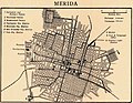 Plan of Merida Yucatan 1919.jpg 1,111 × 861; 782 KB
-
 Plan of Monterrey Mexico 1919.GIF 1,103 × 933; 404 KB
-
 Plans of Inland Towns -2-.jpg 4,017 × 2,486; 923 KB
-
 Plans of Inland Towns -3-.jpg 4,017 × 2,819; 1.19 MB
-
 Plans of Mexican towns 1919-1-.jpg 3,373 × 2,032; 830 KB
-
 Railroad distance map of the United States, Mexico and Canada (14009382364).jpg 2,000 × 1,100; 2.59 MB


.jpg)