Category:1920 maps of Canada
Countries of North America: Canada · Mexico · Nicaragua · Panama · United States of America‡
‡: partly located in North America
‡: partly located in North America
| ← 1920 1921 1922 1923 1924 1926 1927 1928 1929 → |
English: Maps of Canada from 1920 or related to Canada in 1920
Français : Les cartes du Canada de 1920 ou se rapportant au Canada en 1920
Media in category "1920 maps of Canada"
The following 10 files are in this category, out of 10 total.
-
 A". The Labrador Peninsula - btv1b53200590c.jpg 10,015 × 8,868; 10.93 MB
-
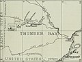
 Annual report (1920) (14592483169).jpg 1,362 × 2,848; 583 KB
-
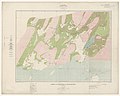
 Annual report (1920) (14798922073).jpg 1,882 × 1,412; 392 KB
-
 Bulletin of the Geological Society of America (1920) (19829119323).jpg 2,068 × 1,336; 637 KB
-

-
-
 E-MJ - engineering and mining journal (1920) (14785229703).jpg 2,080 × 1,554; 342 KB
-
 Graphite (1920) (14598018238).jpg 3,596 × 2,180; 1.7 MB
-
 Graphite (1920) (14804516863).jpg 2,476 × 2,520; 1.2 MB
-
 Water supply of St. Mary and Milk Rivers, 1898-1917 (1920) (14774124504).jpg 4,686 × 2,058; 1.37 MB

_(14592483169).jpg)
_(14798922073).jpg)
_(19829119323).jpg)
,_Algoma_and_Thunder_Bay_Districts,_Ontario._Scale_1_-_253_440_;_C.O._S%C3%A9n%C3%A9cal..._-_btv1b532060554.jpg)

_(14785229703).jpg)
_(14598018238).jpg)
_(14804516863).jpg)
_(14774124504).jpg)