Category:1921 maps of Hawaii
States of the United States: California · Delaware · Hawaii · Idaho · Illinois · Iowa · Louisiana · Maryland · Massachusetts · Michigan · Minnesota · New York · Pennsylvania · South Carolina · South Dakota · Texas · Utah · Virginia · West Virginia · Wyoming
| ← 1921 1926 1927 |
Subcategories
This category has only the following subcategory.
Media in category "1921 maps of Hawaii"
The following 4 files are in this category, out of 4 total.
-
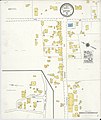 Sanborn Fire Insurance Map from Kapaau, Hawaii County, Hawaii. LOC sanborn01542 001.jpg 6,510 × 7,707; 3.2 MB
-
 Sanborn Fire Insurance Map from Kapaau, Hawaii County, Hawaii. LOC sanborn01542 001.tif 6,510 × 7,707; 143.55 MB
-

-
 Sanborn Fire Insurance Map from Kealakekua, Hawaii County, Hawaii. LOC sanborn01544 001.tif 6,510 × 7,707; 143.55 MB

