Category:1928 maps of Michigan
States of the United States: California · Idaho · Illinois · Kansas · Massachusetts · Michigan · Minnesota · New York · North Dakota · South Dakota · Vermont – Washington, D.C.
| ← 1921 1922 1923 1924 1925 1926 1927 1928 1929 → |
Subcategories
This category has only the following subcategory.
Media in category "1928 maps of Michigan"
The following 2 files are in this category, out of 2 total.
-
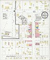
 Sanborn Fire Insurance Map from Rose City, Ogemaw County, Michigan. LOC sanborn04175 003.jpg 6,510 × 7,707; 4.04 MB
-