Category:1930s maps of Alabama
States of the United States: Alabama · Alaska · Arizona · Arkansas · California · Colorado · Connecticut · Delaware · Florida · Georgia · Hawaii · Idaho · Illinois · Indiana · Iowa · Louisiana · Maine · Maryland · Massachusetts · Michigan · Minnesota · Mississippi · Nebraska · Nevada · New Hampshire · New Jersey · New Mexico · New York · North Carolina · North Dakota · Ohio · Oregon · Pennsylvania · Rhode Island · South Carolina · South Dakota · Tennessee · Texas · Utah · Vermont · Virginia · Washington · West Virginia · Wisconsin · Wyoming – Washington, D.C.
Puerto Rico
Puerto Rico
Media in category "1930s maps of Alabama"
The following 2 files are in this category, out of 2 total.
-
 "Birds-Eye View" Map (2784738136).jpg 1,120 × 840; 852 KB
-
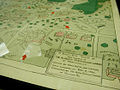
 "Birds-Eye View" Map (detail) (2784738130).jpg 1,120 × 840; 917 KB
.jpg)
_(2784738130).jpg)