Category:1930s maps of Virginia
States of the United States: Alabama · Alaska · Arizona · Arkansas · California · Colorado · Connecticut · Delaware · Florida · Georgia · Hawaii · Idaho · Illinois · Indiana · Iowa · Louisiana · Maine · Maryland · Massachusetts · Michigan · Minnesota · Mississippi · Nebraska · Nevada · New Hampshire · New Jersey · New Mexico · New York · North Carolina · North Dakota · Ohio · Oregon · Pennsylvania · Rhode Island · South Carolina · South Dakota · Tennessee · Texas · Utah · Vermont · Virginia · Washington · West Virginia · Wisconsin · Wyoming – Washington, D.C.
Puerto Rico
Puerto Rico
Subcategories
This category has the following 2 subcategories, out of 2 total.
- 1932 maps of Virginia (2 F)
Media in category "1930s maps of Virginia"
The following 4 files are in this category, out of 4 total.
-

-
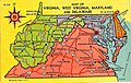 Map of Virginia, West Virginia, Maryland, and Delaware (NBY 2416).jpg 831 × 525; 141 KB
-
-
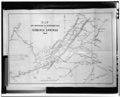
 USGS map of Richmond, Virginia in 1934 (crop showing Broad Street Station).jpg 2,465 × 2,202; 699 KB
.jpg)
.jpg)
.jpg)