Category:1940s maps of Greece
Countries of Europe: Austria · Belarus · Belgium · Bosnia and Herzegovina · Bulgaria · Denmark · Finland · France‡ · Germany · Greece · Hungary · Iceland · Republic of Ireland · Italy · Lithuania · Luxembourg · Netherlands‡ · Norway · Poland · Portugal‡ · Romania · Russia‡ · Spain‡ · Sweden · Switzerland · Turkey‡ · Ukraine · United Kingdom
‡: partly located in Europe
‡: partly located in Europe
Subcategories
This category has the following 2 subcategories, out of 2 total.
- 1944 maps of Greece (2 F)
- 1947 maps of Greece (6 F)
Media in category "1940s maps of Greece"
The following 7 files are in this category, out of 7 total.
-
 1940 German military map - Übersichtskarte Bulgarien-Griechenland.jpg 24,892 × 32,442; 132.82 MB
-
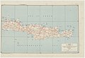 Crete special strategic map - btv1b531895217.jpg 9,008 × 6,152; 4.54 MB
-

-
 Deutsche Heereskarte - Blatt-Nr. I 35 NW KRETA.jpg 23,551 × 14,491; 42.06 MB
-
 IAN 0346.jpg 10,672 × 7,757; 32.78 MB
-
 Greece - btv1b53189499b.jpg 8,424 × 8,180; 8.56 MB
-
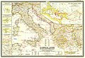 Classical lands of the Mediterranean, 1949.jpg 4,879 × 3,322; 6.41 MB


_-_btv1b531215491_(2_of_6).jpg)