Category:1940s maps of Finland
Countries of Europe: Austria · Belarus · Belgium · Bosnia and Herzegovina · Bulgaria · Denmark · Finland · France‡ · Germany · Greece · Hungary · Iceland · Republic of Ireland · Italy · Lithuania · Luxembourg · Netherlands‡ · Norway · Poland · Portugal‡ · Romania · Russia‡ · Spain‡ · Sweden · Switzerland · Turkey‡ · Ukraine · United Kingdom
‡: partly located in Europe
‡: partly located in Europe
Subcategories
This category has the following 2 subcategories, out of 2 total.
- 1949 maps of Finland (5 F)
Media in category "1940s maps of Finland"
The following 12 files are in this category, out of 12 total.
-
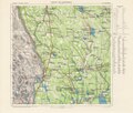
 35927220 Taloudellinen kartta, 1940, karttalehti 103 Joensuu (4).jpg 6,744 × 6,159; 13.31 MB
-
 LEHTI III-10 Viipuri 40.tif 9,670 × 10,745; 14.75 MB
-
 38719394 Pitäjänkartta, 1941, mv, IV36, Luvia, Eurajoki.jpg 6,928 × 7,386; 5.73 MB
-
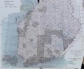
 Orajärvi 1707 1944.tif 8,003 × 6,786; 139.76 MB
-
 Ruotsalainen Sverige-Finland topografinen kartta lehtijako 1944.tif 5,469 × 4,267; 67.4 MB
-
 Syväjärvi 2106 1944 100 000.tif 8,219 × 6,959; 164.28 MB
-
 24239845 Suomen yleiskartta, 1945, karttalehti F4.jpg 6,136 × 7,521; 9.28 MB
-
 Finland 1941.jpg 6,143 × 8,811; 11.52 MB
-
 Finland-map-pravda-1940-03-13-N72.png 1,762 × 2,845; 315 KB
-
 Pitajankartta 1930 1940 luku indeksikartta.pdf 2,081 × 1,712; 984 KB
-
 Suomen kaakkoisosa 1941.jpg 863 × 1,200; 237 KB
-
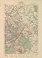
 Vaasa - Vasa 1945.jpg 7,140 × 5,740; 11.03 MB
.jpg)


