Category:1950s maps of Finland
Countries of Europe: Albania · Austria · Belgium · Bulgaria · Denmark · Estonia · Finland · France‡ · Georgia‡ · Germany · Greece · Hungary · Iceland · Republic of Ireland · Italy · Lithuania · Luxembourg · Netherlands‡ · Norway · Poland · Portugal‡ · Romania · Russia‡ · Spain‡ · Sweden · Switzerland · Turkey‡ · Ukraine · United Kingdom
Limited recognition: Abkhazia‡
‡: partly located in Europe
Limited recognition: Abkhazia‡
‡: partly located in Europe
Media in category "1950s maps of Finland"
The following 6 files are in this category, out of 6 total.
-
24239849 Suomen yleiskartta, 1951, karttalehti F4.jpg 6,136 × 7,505; 8.89 MB
-
24239854 Suomen yleiskartta, 1951, karttalehti F4.jpg 6,136 × 7,530; 9.38 MB
-
Bahnhof Tvärminne, Feldbahn Tvärminne.jpg 1,115 × 1,033; 383 KB
-
Militärbahnhöfe Hanko Nord und Süd.png 3,112 × 2,304; 161 KB
-
Suomen tiekartta 1955 nro 8.tif 10,632 × 6,051; 184.7 MB
-
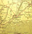
Tammisaari map 1950's.jpg 885 × 961; 481 KB


