Category:1950s maps of Switzerland
Countries of Europe: Albania · Austria · Belgium · Bulgaria · Denmark · Estonia · Finland · France‡ · Georgia‡ · Germany · Greece · Hungary · Iceland · Republic of Ireland · Italy · Lithuania · Luxembourg · Netherlands‡ · Norway · Poland · Portugal‡ · Romania · Russia‡ · Spain‡ · Sweden · Switzerland · Turkey‡ · Ukraine · United Kingdom
Limited recognition: Abkhazia‡
‡: partly located in Europe
Limited recognition: Abkhazia‡
‡: partly located in Europe
Subcategories
This category has the following 9 subcategories, out of 9 total.
- 1950 maps of Switzerland (3 F)
- 1951 maps of Switzerland (2 F)
- 1952 maps of Switzerland (3 F)
- 1953 maps of Switzerland (2 F)
- 1956 maps of Switzerland (2 F)
- 1958 maps of Switzerland (2 F)
- 1959 maps of Switzerland (1 F)
Media in category "1950s maps of Switzerland"
The following 9 files are in this category, out of 9 total.
-
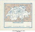 Switzerland - DPLA - 79bcdc99fcf6656ca4fa42b24d60a664.jpg 3,703 × 3,342; 1.57 MB
-
 Switzerland and Liechtenstein - DPLA - ee9e7a26d2510b2ac603457d67c4ce62.jpg 11,986 × 8,711; 9.36 MB
-
 Karte Gemeinden des Kantons Bern farbig 1952.png 2,952 × 2,821; 2.44 MB
-
 Karte Gemeinden des Kantons Graubünden farbig 1953.png 3,836 × 2,751; 2.43 MB
-
 Karte Gemeinden des Kantons Bern farbig 1957.png 2,952 × 2,821; 2.44 MB
-
 Austria, Switzerland, and Liechtenstein - DPLA - 9da982bf8c352a7b5a28c03cf3af249e.jpg 11,345 × 7,393; 9.06 MB
-
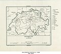 Switzerland and Liechtenstein - DPLA - 0940b5cc1a33b341bf4d7c21c94e4aca.jpg 4,327 × 3,813; 1.94 MB
-
 Switzerland and Liechtenstein - DPLA - a7056bf8a7debab0410c78e4584b1ba5.jpg 11,987 × 8,765; 11.03 MB
-
 Switzerland and Liechtenstein - DPLA - f9b388436437f46d291ed33228b6ff16.jpg 4,335 × 3,833; 1.73 MB


