Category:1950s maps of the United Kingdom
Countries of Europe: Albania · Austria · Belgium · Bulgaria · Denmark · Estonia · Finland · France‡ · Georgia‡ · Germany · Greece · Hungary · Iceland · Republic of Ireland · Italy · Lithuania · Luxembourg · Netherlands‡ · Norway · Poland · Portugal‡ · Romania · Russia‡ · Spain‡ · Sweden · Switzerland · Turkey‡ · Ukraine · United Kingdom
Limited recognition: Abkhazia‡
‡: partly located in Europe
Limited recognition: Abkhazia‡
‡: partly located in Europe
Constituent countries of the United Kingdom: England
Subcategories
This category has the following 5 subcategories, out of 5 total.
E
Media in category "1950s maps of the United Kingdom"
The following 2 files are in this category, out of 2 total.
-
Laysters in Ordnance Survey SO56 - OS 125,000 map 1956.jpg 1,244 × 903; 1.8 MB
-
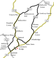
Clypse Course.svg 608 × 655; 43 KB

